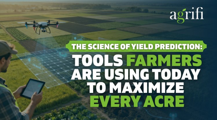
Data-Driven Farming: How Drones Are Revolutionizing Agriculture with Precision Intelligence
Explore how agricultural drones are transforming farming with real-time data, AI-powered insights, and precision irrigation. Discover case studies from Japan, India, the U.S., Africa, and Australia showcasing measurable results in yield, efficiency, and sustainability.
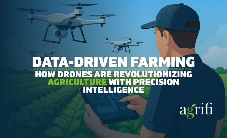
Agriculture, the cornerstone of human civilization, is undergoing a profound transformation. At its epicenter is the integration of technology, with drones emerging as pivotal tools. Beyond mere aerial vehicles, these unmanned systems are evolving into sophisticated data-gathering platforms, empowering farmers with previously unimaginable insights.
Agriculture is no longer about tilling soil and hoping for favorable weather; it’s about collecting data, analyzing trends, and making real-time, evidence-based decisions. At the heart of this transformation are drones, not just as flying machines, but as intelligent, data-rich platforms.
A single agricultural drone can collect 50,000+ data points per acre and analyze 14 different light spectrums in one flight.
That’s not just innovation. It’s a revolution in how we farm.
The Data Revolution in Agriculture
The global food system is under immense pressure. A burgeoning population, shrinking arable land, and the specter of climate change demand innovative solutions. Precision agriculture, a data-centric approach to farming, is emerging as a key strategy. Drones, with their ability to capture vast amounts of data, are propelling this revolution.
The Challenge Scale:
● Population growth: 9.7 billion people by 2050 requiring 70% more food production
● Land loss: 1.5% of arable land is lost annually to urbanization and degradation
● Climate impact: Extreme weather events increased 300% since 1980s, threatening traditional farming
The Data Response:
● Market growth: Agricultural drone market expanding from $2.74 billion (2024) to $5.7 billion (2030)
● Adoption acceleration: 25% compound annual growth rate in drone-based farming solutions
● Efficiency gains: Farms using drone data report 15-30% yield improvements
Equipped with high-resolution cameras, multispectral sensors, and GPS technology, drones transform fields into data-rich environments. The information gleaned from these aerial surveys provides farmers with an unprecedented understanding of their crops, soil, and topography.
The true value of drone data lies in its ability to inform precise, data-driven decisions. By processing drone imagery with advanced algorithms, farmers can pinpoint areas with nutrient deficiencies, water stress, or pest infestations. This granular level of information enables targeted interventions, such as applying fertilizers or pesticides only where needed, optimizing resource utilization and minimizing environmental impact.

The Challenge: Japan's aging farmer population (average age 67) manages 2.4 million hectares of rice fields across challenging mountainous terrain.
The Innovation: Nileworks developed drones that fly just 30 centimeters above rice ears, using onboard AI to analyze individual plant photosynthesis, seed development, and growth patterns in real-time.
The Data Power: Each drone flight processes:
● Individual plant analysis: Health assessment of every rice stalk
● Photosynthesis measurement: Real-time chlorophyll activity monitoring
● Seed counting: Automated yield prediction with 94% accuracy
● Growth mapping: Precise development stage identification
The Results:
● Yield prediction: 94% accuracy 4 weeks before harvest
● Chemical reduction: 40% decrease in pesticide applications
● Labor efficiency: 50% reduction in manual field inspection time
● Economic impact: $127,000 annual savings per 1,000-acre operation
Furthermore, drones equipped with thermal sensors can detect subtle temperature variations, indicating potential disease outbreaks or irrigation issues. Early detection is crucial: Nileworks' system identifies crop diseases 7-10 days before symptoms become visible to human eyes, allowing farmers to implement timely countermeasures and safeguard crop yields.

The Challenge: India's cotton farmers facing 70% resource waste due to imprecise chemical applications and irregular pest management.
The Innovation: Fuselage Innovations designed precision nozzles based on plant absorption rates, optimizing droplet size for maximum uptake efficiency.
The Data Science:
- Microsize analysis: Calculating optimal droplet size for different growth stages
- Absorption modeling: Plant-specific uptake rate algorithms
- Application mapping: GPS-guided precision spraying with 95% accuracy
- Resource optimization: Real-time spray drift monitoring and adjustment
The Results:
The sheer volume of data generated by drones necessitates advanced analytical tools. Artificial intelligence (AI) and machine learning (ML) are at the forefront of unlocking the data's potential. These technologies can identify patterns, predict outcomes, and optimize farming practices at an unprecedented scale.
Data Volume Reality: Agricultural drones generate 50-100 GB of data per 1,000-acre survey, requiring sophisticated processing capabilities:
- Onboard AI: Drones process imagery during flight using edge computing
Step 2: Cloud-Based Deep Learning
Step 3: Decision Support Systems
Case Study 3: Africa's Smallholder Empowerment - Malawi Data Literacy Program

The Challenge: Smallholder farmers in Malawi manage 0.5-2 hectare plots with limited resources and traditional knowledge.
The Innovation: Simple smartphone apps translate complex drone data into actionable insights for farmers with basic literacy.
The Data Democratization:
The Results:
For instance, AI algorithms can analyze historical drone data to forecast optimal planting and harvesting times based on weather patterns and soil conditions. Machine learning models can identify crop diseases with remarkable accuracy, empowering farmers to apply targeted treatments.
The ability to monitor crops in real-time is a game-changer for farmers. Drones provide up-to-the-minute information on crop health, soil moisture, and weather conditions. This enables rapid responses to evolving situations, such as adjusting irrigation schedules or applying pesticides when conditions are optimal.

The Challenge: California's Central Valley is facing severe drought restrictions threatening $50 billion agricultural economy.
The Innovation: Thermal imaging drones identify water stress patterns invisible to human observation.
The Data Insights:
The Results:
The Market for Agricultural Drones: A Booming Industry with Concrete Data
The agricultural drone market is experiencing explosive growth. According to Fortune Business Insights, the global market for agricultural drones is projected to reach $5.7 billion by 2030, growing at a 25% compound annual growth rate. This rapid expansion is driven by several factors, including increasing food demand, the need for sustainable agriculture, and technological advancements.

Key market trends include:
Precision Irrigation - The Water Intelligence Revolution
One compelling example of drone data in action is precision irrigation. By meticulously analyzing soil moisture data collected by drones, farmers can optimize water usage, reducing waste and conserving this precious resource. Additionally, drones can identify areas with waterlogging, preventing crop damage and maximizing yields.
Traditional Irrigation Problems:
Drone-Powered Solutions:
Case Study 5: Australia's Vineyard Precision - Treasury Wine Estates
The Challenge: Managing 11,000 hectares of vineyards across varying terrain and microclimates while maintaining wine quality standards.
The Innovation: Integrated drone and IoT sensor networks providing comprehensive vineyard intelligence.
The Data Integration:
The Results:
The Future of Drone Agriculture: What’s Next in Aerial Agri-Intelligence
The future of drone-powered agriculture is shifting rapidly toward automation, integration, and intelligence at scale. One key trend is the use of autonomous drone swarms, capable of scanning and treating thousands of acres simultaneously with real-time coordination. Combined with 5G connectivity and edge AI, these systems allow for near-instant insights and automated responses in the field.
Another emerging breakthrough is hyperspectral imaging, which detects plant health at the molecular level, far before visual symptoms appear. This enables ultra-early disease and stress intervention, especially when processed through platforms like Agrifi’s AI engine.
We're also seeing an increase in the use of blockchain-integrated traceability, where drone-collected crop data is securely recorded and verified across the entire supply chain. This boosts transparency and value for export-quality produce and sustainable farming practices.
Agrifi Tech is helping lead this shift by integrating drones with AI, IoT, and smart dashboards, building the foundation for fully autonomous, data-driven agricultural ecosystems. These trends aren't theoretical; they're the roadmap for tomorrow’s precision farming.
The integration of drones into agriculture is still in its nascent stages, yet the potential is immense. As drone technology continues to evolve and data analytics capabilities improve, we can anticipate even more groundbreaking applications.
The Sky Is No Longer the Limit, It’s the Starting Point
Agriculture is at a critical crossroads. As the world confronts climate change, resource scarcity, and rising food demand, the need for smart, sustainable, and scalable farming solutions has never been greater. Drones, powered by AI and analytics, have emerged not merely as tools but as transformative allies in the fields, turning invisible risks into visible insights and fragmented operations into optimized systems.
Agrifi Tech stands at the forefront of this evolution. By uniting drone technology, AI modeling, IoT integration, and intelligent dashboards, Agrifi delivers a truly data-first farming platform. Our mission is to help farmers move from intuition to intelligence, from reaction to prediction, and from uncertainty to sustainability.
In this era of aerial agri-intelligence, the farms that thrive will be those that adapt swiftly, adopt boldly, and act precisely. The future of agriculture isn’t just about better tools—it’s about building a smarter, more resilient food system for all. And that future is already airborne.
The future of farming is data-driven, and it's taking flight right now.
FAQ
Q1. What is precision agriculture, and how do drones support it?
A: Precision agriculture uses data and technology to optimize farm inputs like water, fertilizer, and pesticides. Drones support this by capturing real-time aerial data, identifying crop issues early, and enabling targeted interventions.
Q2. How is Agrifi Tech different from other drone farming platforms?
A: Agrifi Tech offers an end-to-end ecosystem that integrates drones, AI, IoT sensors, and cloud-based decision dashboards. Unlike standalone drone services, Agrifi turns raw field data into actionable insights that drive measurable yield and cost improvements.
Q3. How accurate are AI predictions from drone data?
A: With platforms like Agrifi’s, disease detection can reach up to 94% accuracy, and yield predictions are possible 3–4 weeks in advance using multispectral and historical data analysis.
Q4. Can small farmers benefit from drone farming?
A: Absolutely. Case studies like the Malawi Data Literacy Program show how even smallholders with minimal tech experience achieved a 28% yield increase by using visual insights and localized recommendations from drone data.
Q5. What crops or regions benefit most from drone agriculture?
A: Drones are adaptable across crop types and terrains, from rice in Japan, cotton in India, vineyards in Australia, to smallholder farms in Africa. The technology is especially valuable in regions facing water scarcity, labor shortages, or harsh climates.
Q6. Is drone farming sustainable?
A: Yes. Drone-guided precision reduces water use by 40–50%, cuts chemical runoff by up to 60%, and ensures environmentally responsible input use, making it a core driver of sustainable, climate-smart agriculture.
Q7. What's next for Agrifi Tech and drone agriculture?
A: Agrifi is investing in next-gen features like autonomous drone swarms, real-time 5G processing, and AI-powered treatment automation. The vision is to enable predictive, scalable farming ecosystems that can adapt to climate change and global food demand.
What's Your Reaction?